



LS-S4 Series High Precision Long-Range Ultra-High-Definition Fiber Laser LiDAR
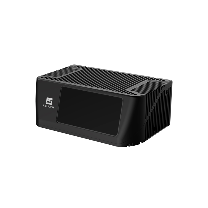

Top-Performance 1550nm LiDAR: Longer Range, Higher Precision, Denser Point Cloud
Key Features:
- Ultra-long range LiDAR with up to 1500m detection capability
- 1550nm fiber laser for enhanced long-distance sensing performance
- High precision up to ±5cm for accurate object detection
- Generates up to 6 million points per second for dense data
- Supports up to 20Hz frame rate for real-time applications
- Designed for autonomous systems, drones, and long-range monitoring
Description
Product Overview
The LSLiDAR LS-S4 is an ultra-long range high-resolution LiDAR designed for advanced perception, mapping and autonomous systems operating in large-scale environments. Using a 1550 nm fibre laser architecture, it delivers exceptional detection range and precision, enabling accurate identification of objects at extreme distances. With high channel density, configurable scanning and strong anti-interference performance, the LS-S4 is built for applications such as autonomous driving, smart infrastructure, surveying and long-range security monitoring, where both range and detail are critical.
Key Features
Ultra Long Range Detection
-
Detection range up to 1000 m to 1500 m, depending on configuration
-
Capable of detecting low reflectivity targets at long distances
-
Suitable for highway speed perception and large area monitoring
-
Designed for early object detection and long distance awareness
High-Density 3D Perception
-
Up to 216 or 360 channel configurations, depending on model variant
-
Generates up to 6 million points per second for detailed point cloud output
-
High data density supports accurate object classification and tracking
-
Suitable for high-precision mapping and sensor fusion systems
High Accuracy Measurement
-
Range precision around ±5 cm for consistent distance calculation
-
Time of flight measurement ensures stable and repeatable results
-
High-resolution angular performance for detailed scene reconstruction
-
Maintains accuracy across varying environmental conditions
Advanced Scanning and Resolution
-
Adjustable frame rates up to 10 Hz or higher, depending on configuration
-
Fine angular resolution for both horizontal and vertical scanning
-
Supports region of interest scanning for optimised data capture
-
Designed for balancing long-range coverage and high-resolution detail
Industrial and Automotive Grade Design
-
IP67-rated enclosure for protection against dust and water
-
Operating temperature range from -20°C to 65°C
-
Resistant to vibration and shock for mobile and industrial deployments
-
Designed for continuous operation in demanding environments
Connectivity and Integration
-
Gigabit Ethernet interface for high-speed data transmission
-
Supports GNSS synchronisation, including PPS and GPS timing
-
Wide DC input range for industrial power systems
-
Compatible with autonomous platforms, infrastructure systems and edge processing
More Information
| Brand | LSLIDAR | ||||||||||||||||||||||||||||||||||||||||||||||||||||||||||||||||||||||||||||||||||||
|---|---|---|---|---|---|---|---|---|---|---|---|---|---|---|---|---|---|---|---|---|---|---|---|---|---|---|---|---|---|---|---|---|---|---|---|---|---|---|---|---|---|---|---|---|---|---|---|---|---|---|---|---|---|---|---|---|---|---|---|---|---|---|---|---|---|---|---|---|---|---|---|---|---|---|---|---|---|---|---|---|---|---|---|---|---|
| Specifications |
Model: LS216S4
Model: LS360S4-A/B
|
Ordering Information
|
SKU |
Description |
|---|---|
|
LS216S4 |
216-channel TOF LiDAR sensor, 1550nm wavelength, up to 1000m range, 60° horizontal FOV, high-resolution long-range detection for industrial and autonomous applications |
|
LS360S4-A |
360-channel TOF LiDAR sensor (Variant A), 1550nm wavelength, up to 1500m range, wider 28.5° vertical FOV, optimised for long-range, high-density point cloud generation |
|
LS360S4-B |
360-channel TOF LiDAR sensor (Variant B), 1550nm wavelength, up to 1500m range, narrower 27.5° vertical FOV with enhanced ROI resolution for precision-focused detection |
Need something specific?
We build to order.
We can customise any solutions according to your specifications. Click below to learn more
and contact us.